ST MICHAEL'S
Zoning
The Zoning lines changed from the 1990 map to the current
on . It is possible that this happened in a Township
wide rezoning in 1996 -- no clear data yet
 THE 2 ZONES
St Michael's is zoned
CS -Community
Service (click here for the whole thing )
on the left
and
R1 Residential
(click here) where 1 single family residence per acre
is allowed on the right . A portion of the section on the right
was designated
Flood
Plain Conservation District on the 1990
plan . That is another whole kettle of fish -
so click
here for that . But
we still have some uncertainty how the original P
zoning got to be CS and when and how much of it is CS
....
THE 2 ZONES
St Michael's is zoned
CS -Community
Service (click here for the whole thing )
on the left
and
R1 Residential
(click here) where 1 single family residence per acre
is allowed on the right . A portion of the section on the right
was designated
Flood
Plain Conservation District on the 1990
plan . That is another whole kettle of fish -
so click
here for that . But
we still have some uncertainty how the original P
zoning got to be CS and when and how much of it is CS
....
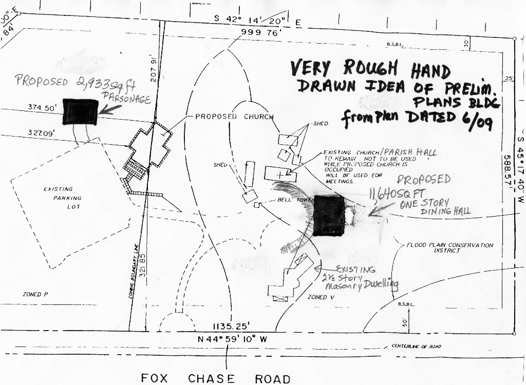
THE
EXCEPTIONS GRANTED They had to make an
exception from the code for the Community Service Building to be built
in the R1 district and for the expansion to be more
than what was allowed ( only 25% more than what existed at the
time of the granting of the non-conforming use was allowed .
And an exception was made to build a Church/Place of Worship CS use
on an R1 residential lot -
and the plot plan now (2008 and on ) makes a clear
designation of CS to the left of the land . We don't yet have
the minutes from the 1990 meeting to know if an exception
was made or if it was rezoned . But why would the line
have changed?
WHERE ARE THE ZONING LINES ?
see the dotted line Top to bottom dividing the map into left and right
portions . From the point nearly in the
middle of Pond View Rd go straight back to the point nearly in the
middle of 1078 Kipling's backyard
line on the 2009 Plan below. The left side with the parking lot and the log church
was zoned
Community Service .
The right side with the old parish hall, the
current masonry dwelling and the new planned dining/banquet hall
was/is zoned R1 ( residential ) . The waiver was
granted in 2008 to build the CS building in the R1 side and to
expand more than 25%
Then look below to the 1990 plan to see the zoning line which
this time is further to the left and cuts through the new log
church . It is possible ( maybe likely ) that this
happened in a Township wide rezoning in 1996 -- no clear data
yet
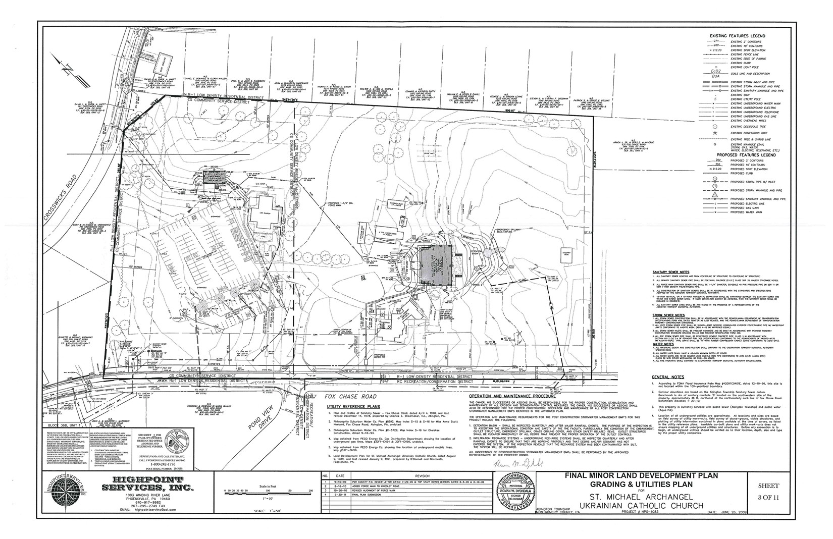
Above - the line is to the right of the church and comes
down to the left edgeof the driveway entrance
Below the line cuts through the church and ends quite far to the
left of the driveway
Our codebook is in 2 parts
Part 1
Township's
Codebook
except for zoning
Part 2
Zoning Portion of Township Codebook
or go to
http://www.abingtonpa.gov/info/newcodebook.htm
__________________________
Please feel free to
contact us
with your own
information on these topics and please be sure
to
contact us
about any information you believe to be
incorrect -
|